In association with the Leverhulme Wildfires Summer Conference 2026, we are running competition to find photographs and accompanying narratives that best communicate the impressive work of Early Career Research (ECRs) studying wildfires.
Conference attendees and the public are invited to vote for the People’s Choice award worth £150! The Judge’s Awards are worth £250 (winner) and £200 (runner up), to be judged by Elisabed Gedevanishvili (Imperial College London) and Amos Chege Muthiuru (King’s College London, the 2023 People’s Choice winner)
TO VOTE (voting closes at 4pm BST, Wednesday 22nd July) – please fill in the form here.
Please enjoy the virtual exhibition below.
Copyright belongs to the photographer and photographs should not be used without permission
Wildfires Research Through the Lens II
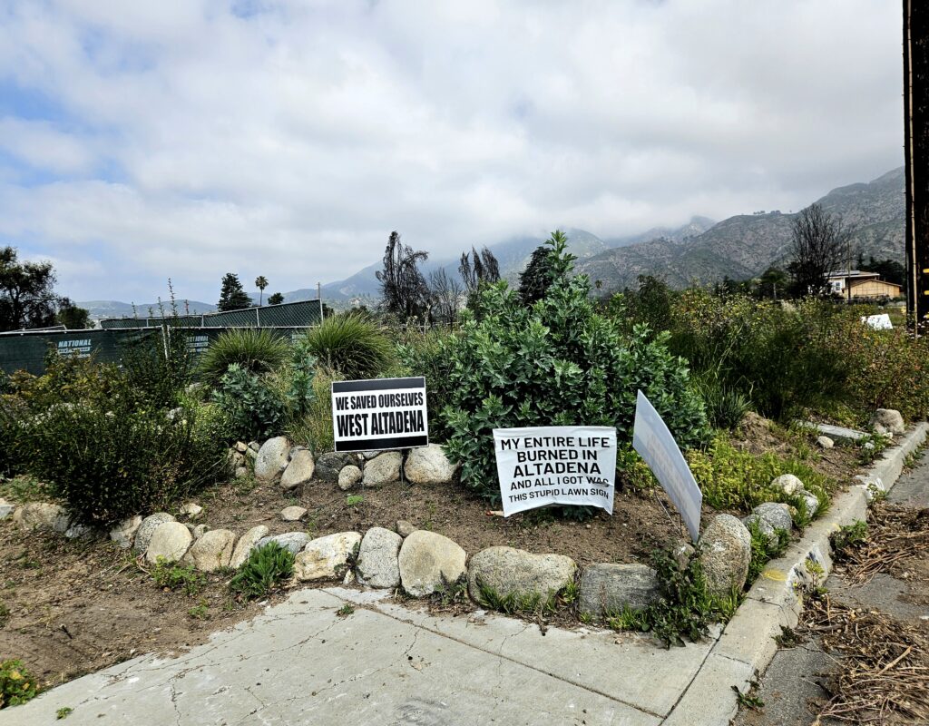
1. The “Double Disaster”
Abi Croker | Princeton University
When the 2025 Los Angeles urban conflagration rapidly spread through Altadena, many of the suppression resources had already been directed towards the Pacific Palisades, leaving this community highly vulnerable to loss and damage. This already marginalised community are now fighting for their homes as big developers are increasingly moving in to take advantage of this highly sought after land. One year on, many of the town’s original residents are still residing in hotels… but this relief aid has now expired. What next?
2. Drawing Fire
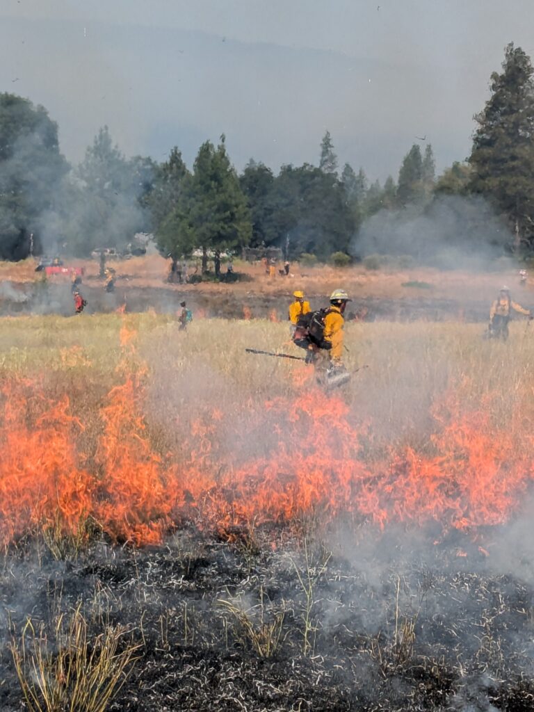
Alex Mines | Imperial College London
Taken while assisting data collection from a Yellow Starthistle Prescribed Burn Training Exchange in Hyampom, California.
This image shows Firefighters deep within a prescribed burn, disconnected from Researchers by a wall of flame. This symbolises the intense barrier that must be overcome by researchers and practitioners in order to understand one another’s perceptions of fire management and maintain opportunities to develop co-productive research.
While this prescribed burn was beneficial by removing invasive Yellow Starthistle from the grasslands, these opportunities for inter-stakeholder exchanges are beneficial to the development of holistically minded fire research. Every researcher must engage with real-world practitioners to ensure each other’s perceptions of fire are understood.
3. Walking the Line
Cathy Smith | Royal Holloway University of London
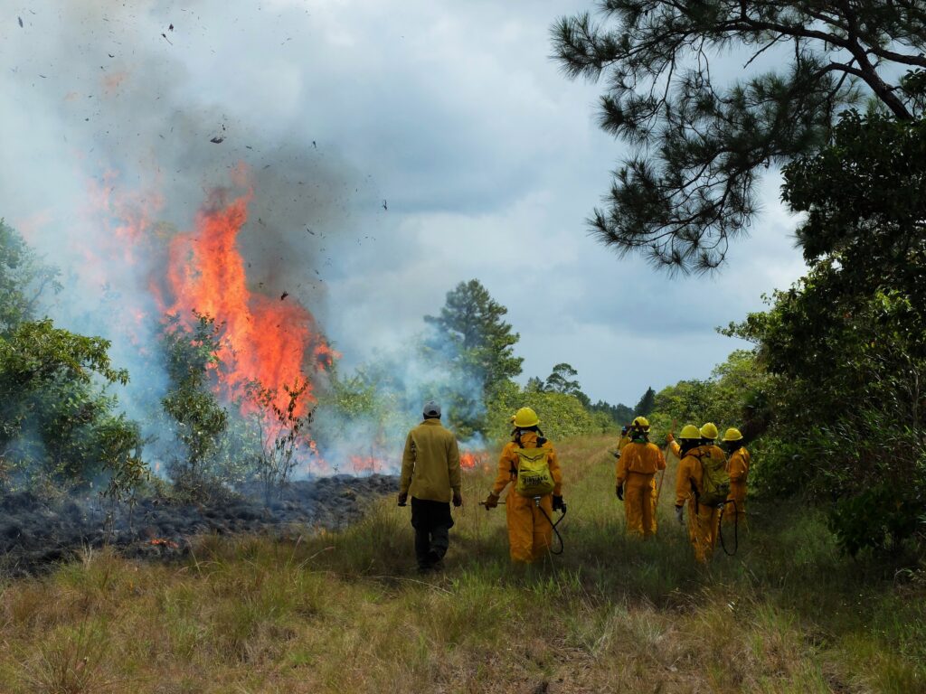
A palmetto palm explodes into flame during a prescribed burn, part of community fire training in the coastal savannas of Southern Belize. For a century, fire in this landscape was suppressed and managed first by the colonial Forestry Department, then by local non-governmental organizations. Led by local rangers, this prescribed burn was one of the first in Belize to involve community members directly, bringing together people from the country’s four main ethnic groups: Maya, Mestizo, Creole, and Garifuna.
4. From Ice to Fire
Fanhui Dong| University of Leeds
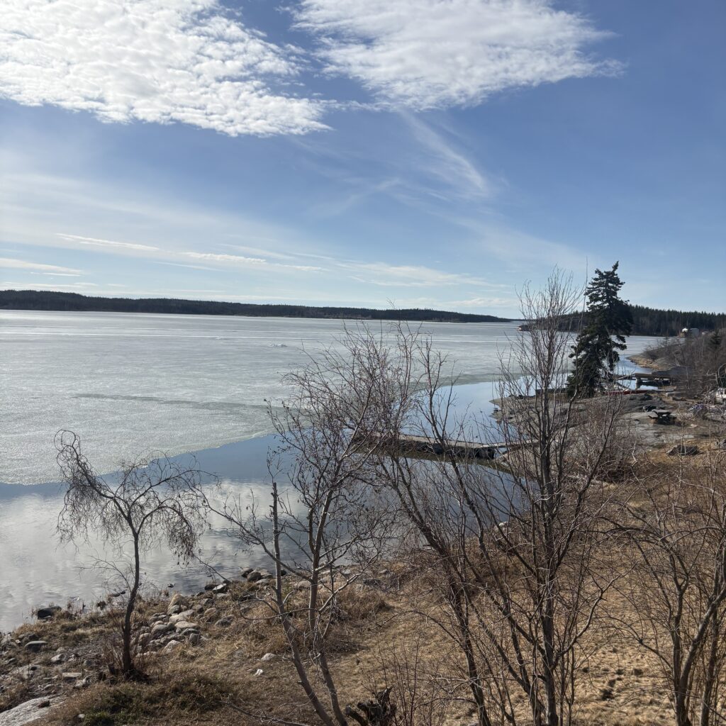
Northwest Territories (NWT), Canada, in May – As the ice melts, the exciting summer returns to the North. The whole NWT also comes with another certainty: the wildfire season is fully back. The drought, water levels, lightning, and active camping activities—it is another year of fighting fires and living with the fires. The forest is quiet for now, but people living here know fire is close ahead.
5. Agricultural Fire in the Amazon
Farrer Owsley-Brown| King’s College London
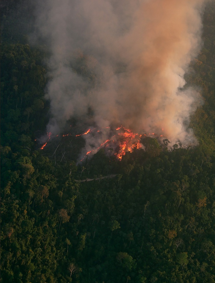
Taken from a research aircraft near Uruará, Pará state, Brazil, this captures an active slash-and-burn at sunset, with visible flames and a smoke plume rising above the rainforest canopy. Here, progressive deforestation radiates outward from a main road in a characteristic “fishbone” pattern, a recognised signature of forest fragmentation in the Amazon. For smallholder farmers, felling, piling and burning forest is an accessible means of supporting their livelihoods. These fires also serve large-scale agribusiness supplying global markets. Witnessing this was both exhilarating and sobering. But studying these fires with objectivity improves our understanding of their impacts on one of the world’s most biodiverse and carbon-rich regions, whilst informing policymakers.
6. From Savanna to Structure: Decoding Firebrand Risks for African Homes
Guy Godiraone Yuyi| Botswana University of Agriculture and Natural Resources
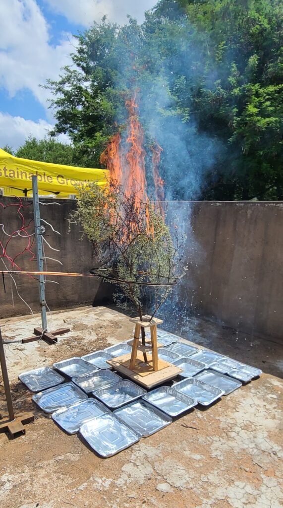
Contemporary Wildland-Urban Interface (WUI) fire models are skewed towards Northern Hemisphere conifer data, creating a critical “North-South Gap” in wildfire science. The above image addresses this disparity through permitted, destructive sampling of ecologically significant Southern African species. The image displays an experimental setup designed to empirically characterize the combustion profiles and firebrand generation of local vegetation: Vachellia tortilis. By quantifying species-specific radiant flux and ember production, this setup provides the inaugural localized datasets for Botswana. These findings are critical for calibrating fire-spread models, ultimately enabling the design of “Fire-Smart” residential constructs tailored to the unique fuel dynamics of the African savanna in a changing Climate.
7. The Illusion of Coolness
Hafizha Mulyasih| Imperial College London
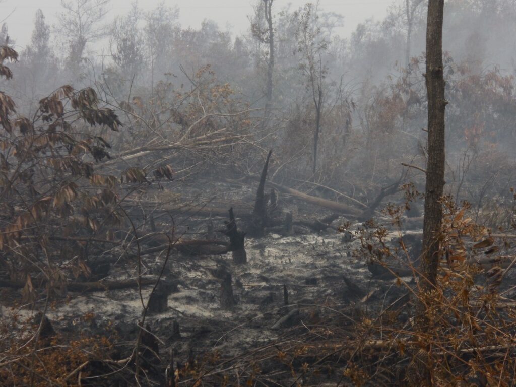
Taken during the 2019 Borneo peat fires, this image shows a landscape covered in smoke after intense burning of peatland forests. The grey haze creates a quiet and seemingly cool atmosphere, yet it hides severe ecological damage beneath the surface. Charred vegetation, fallen trees, and scorched peat reveal the long-lasting effects of fires that release stored carbon and threaten biodiversity. In the context of research on climate change and land-use impacts, this scene illustrates how a calm appearance can mask a deeper environmental crisis affecting ecosystems, communities, and global climate.
8. Measuring Emissions from Prescribed Fires
Marissa Dauner | King’s College London
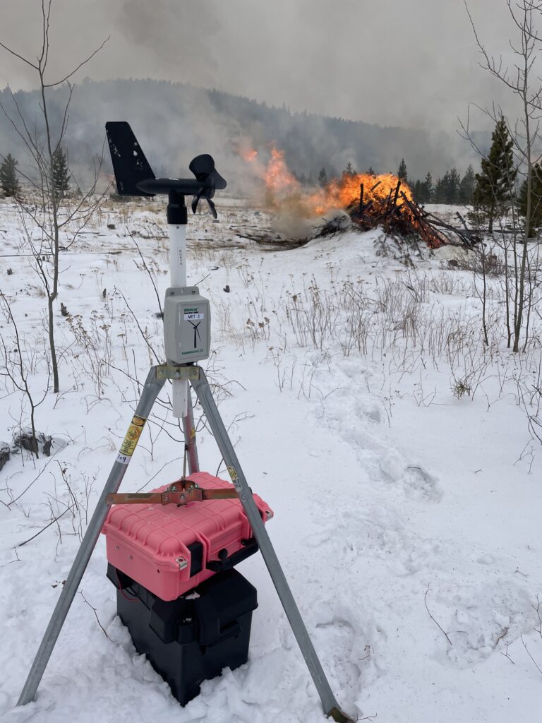
Since 2023, Boulder County Fire Management has enabled researchers from the Hannigan Air Quality Lab at the University of Colorado Boulder to deploy novel low-cost sensor arrays for quantifying emissions from a variety of prescribed burning activities. This large hand pile was one of several located in Reynolds Ranch near Nederland, Colorado ignited on January 10, 2024. In the foreground, one of four battery-powered sensor “pods” deployed at this burn is shown which recorded six pollutants and wind speed/direction.
9. Swidden in the Shadow of Climate Change
Michel Valette | Imperial College London
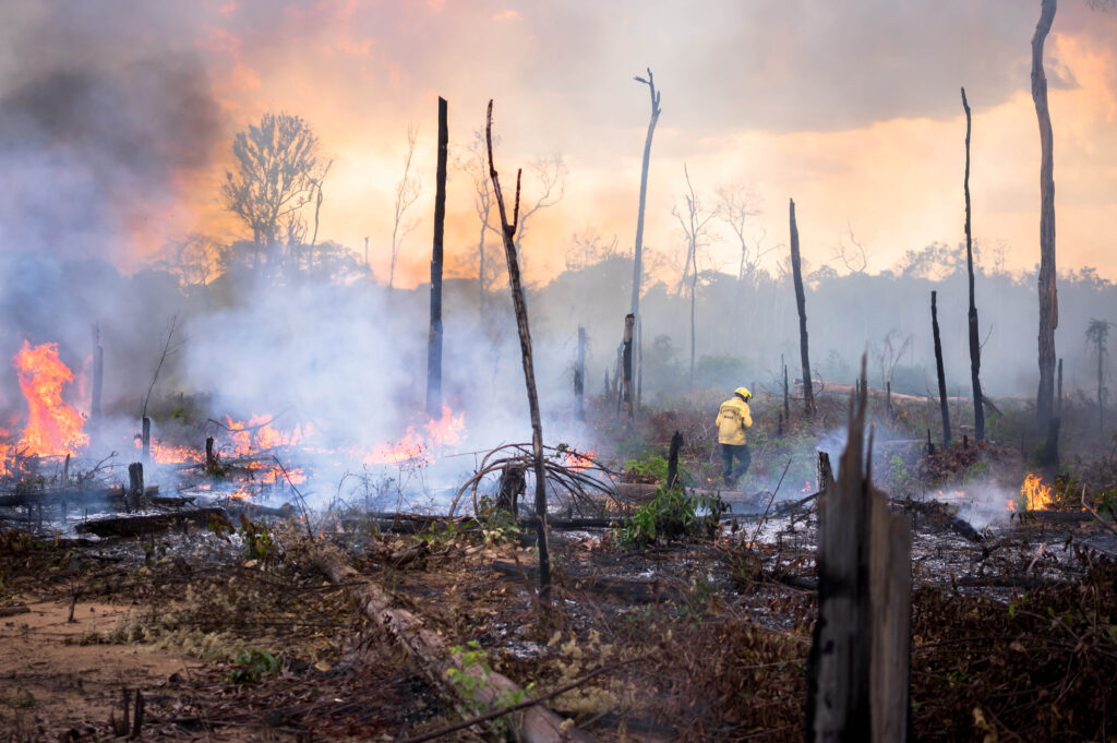
Early afternoon, September 2025. Dark clouds gather over Capoto/Jarina, promising the rain that makes swidden burning safe and effective: ashes will percolate into the soil while escaping fires will be quickly quenched. But climate change is reshaping rainfall seasonality, and dark clouds no longer necessarily mean rainfall. After the destructive wildfires of 2024, burning alone felt too risky. Most swiddens in 2025 were burned with the Capoto/Jarina Indigenous fire brigade, blending scientific, expert and traditional fire knowledge to support local fire practices. This afternoon, the rain never came. The fire, however, stayed exactly where it was meant to, prepping the swiddens for a new cycle of abundance.
10. The spirit of fire hides in the smoke
Outi Kinnunen | Finnish Meteorological Institute
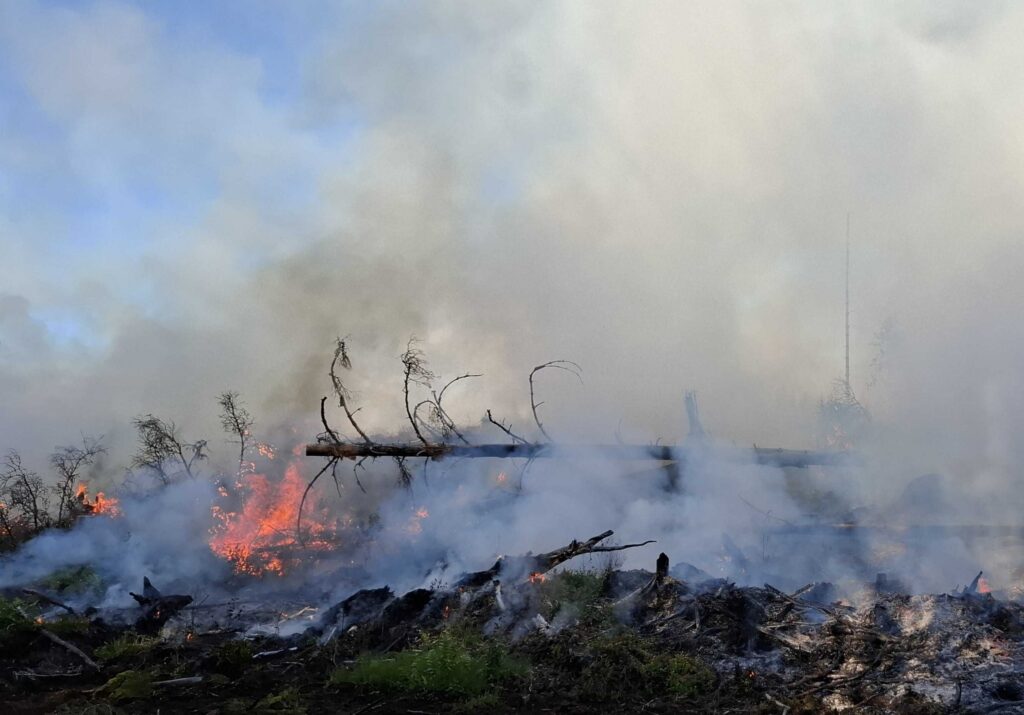
This is not a smokescreen. This is real smoke, in which the spirit of fire is hidden. I followed the prescribed burning in southern Finland. The atmosphere was utopian – the heat, the sound and the smoke of the flames. As a researcher, I do modeling, and this was my first experience in a wild fire. I saw the power of the fire and felt the danger of burning. The experts planned and managed this well. This was done to increase biodiversity and support species that depend on high temperatures and charred wood.
11. White smoke, wet fuel
Tom Eames | University of Exeter
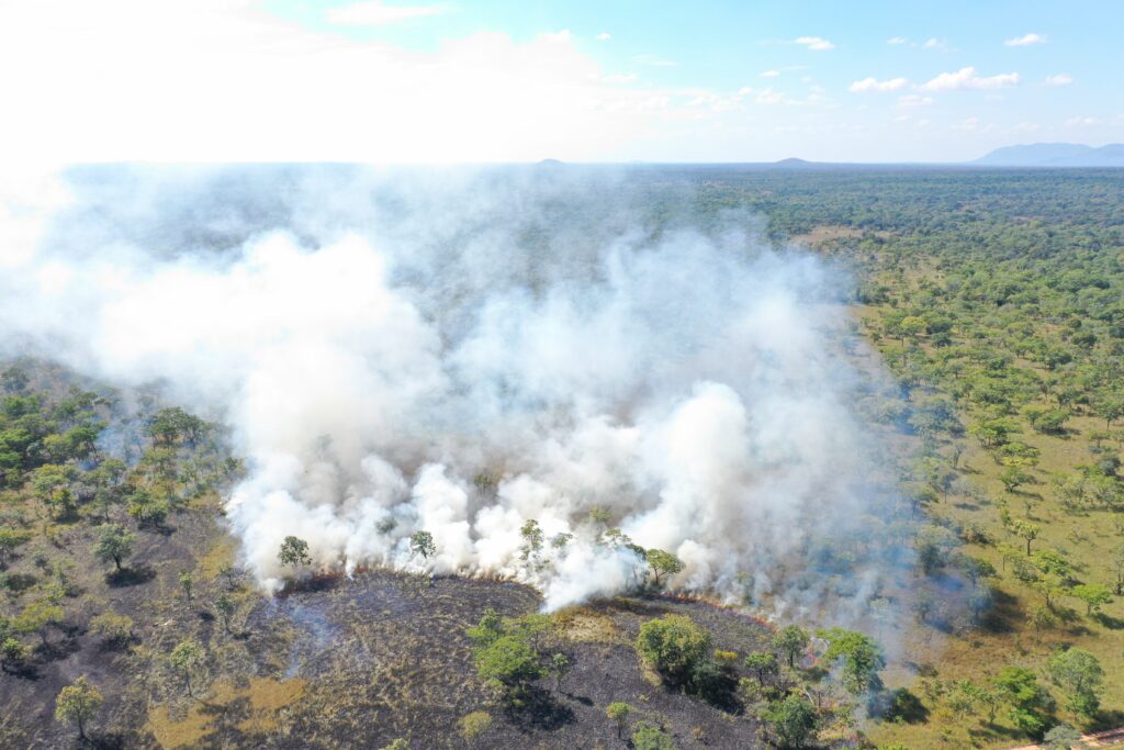
A drone shot of an early dry season fire in a grassland Niassa Special Reserve, northern Mozambique. This fire was part of our comparison between early and late dry season fire emissions in tropical savannas, where we measured emissions of several gases in smoke plumes across the dry season. This fire was unusual in that the grass was still relatively green when it burned, meaning that there were comparatively high carbon monoxide and methane emissions. If you look closely, just above the leftmost tree in the fire front, you can see our sampling drone in the plume!
12. Cutting Fire’s Path
Zahra Mousavi | University of Exeter
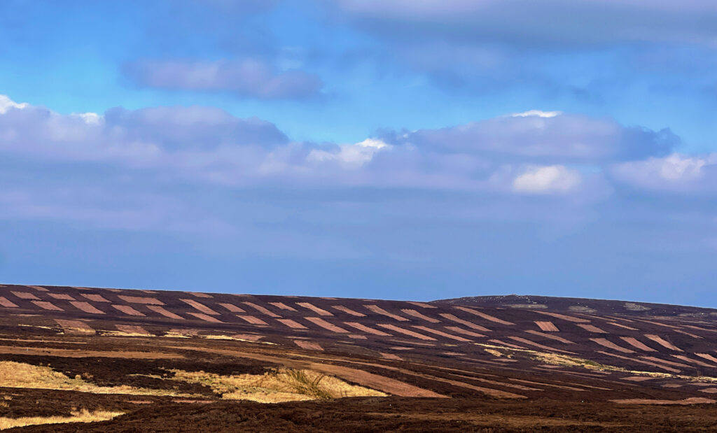
This image shows a moorland landscape in the Peak District, cut into long, alternating strips of heather. Rather than being burned, the vegetation is mechanically mown in bands of different ages, creating a striking mosaic across the hillside. My research investigates how this kind of management affects the way wildfire spreads across the moor. By leaving some strips uncut while regularly mowing others, land managers create a patchwork of habitat structures, which can benefit ground-nesting birds and insects while reducing wildfire risk. This photograph captures the scale and geometry of that management at a landscape level.
13. The Last Line of Defence
Ariba Shahab | Aligarh Muslim University
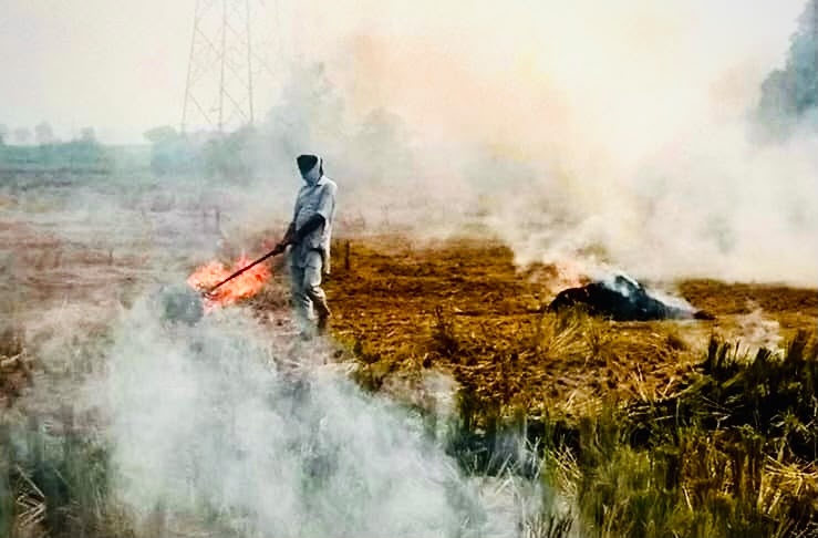
I watched him standing alone as smoke drifted across his field, using nothing more than a stick to push the flames away from the land that fed his family. There were no fire engines, no protective equipment and no one coming to help. The wildfire had spread from the nearby forest, leaving him to fight for what remained. I remember wondering how much could really be saved. While the flames would eventually die, I realised the damage would not end there. My research asks what happens after the smoke clears, investigating how fire disrupts pollinator communities and the ecosystems and livelihoods that depend on them.
14. Where Fire Sighs Beneath?
Jinchang Deng | Nanjing University of Information Science and Technology
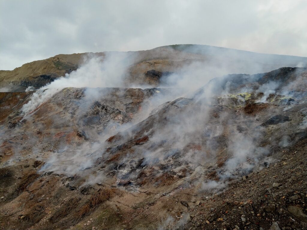
Few people know this landscape hides a coal seam smouldering silently for two decades. I entered Urumqi’s Sandaoba fire zone in 2019, where choking smoke left me coughing in tears, while extreme ground heat almost melted my shoes. Cracked rocks, scorched vegetation, and toxic gases made every single step perilous. Only a few hundred meters away, villagers and grazing lands continue their daily lives. Coal mining once brought prosperity here, yet abandoned mines now feed this prolonged underground wildfire. This experience marked the beginning of my research on fire safety and environmental impacts, driven by the hope that these hidden industrial legacies can be seen, understood, and eventually remediated.