Applications are invited for a fully funded PhD in the Remote Sensing of Landscape Fire, to be based in the Department of Geography, King’s College London. Funded by the National Productivity Investment Fund (NPIF) and delivered through the London NERC London DTP, the PhD relates to the NPIF themes of transformative digital technologies, satellites/space technologies, and AI/machine learning.
Project Outline
Background: Wildfires, deforestation fires and agricultural burning are Earth’s greatest natural disturbance agent, affecting on average an area equivalent to that of India every year, changing landcover over huge areas and releasing massive amounts of smoke into our atmosphere. In recent years wildfires have made headlines in Australia, California, continental Europe and even the UK, and satellite data are the only way to robustly track and quantify the phenomena across such large scales, something that can now be done close to real-time. Our ability includes detecting fires through the electromagnetic signals they emit whilst they are still burning, and in addition to identifying where fires are, such signals also contain information useful for understanding fire behaviour. Two traits of particular interest are fire intensity and combustion phase (CPh; i.e. smouldering vs. flaming) which strongly influence the amount and chemical composition of smoke and in turn controls its impact on the atmosphere and on air quality. Whilst satellite data are commonly used to identify where fires are burning, there are no proven means currently of extracting information these fire characteristics, and even detecting the fires requires use of manually tuned algorithms that are time-consuming to optimise. The ephemeral and rapidly changing nature of fires also means that such satellite-derived information has been subject to relatively limited validation. Airborne remote sensing can provide highly detailed data for the development and validation of algorithms to estimate fire characteristics from satellite data, and can be informed by prior laboratory studies helping to optimise the nature of the phenomena and measurements targeted by the airborne sensing.
Aims: The studentship will explore use of multi- and hyper-spectral laboratory and airborne remote sensing in characterising landscape fires, and ultimately the use of such metrics to help improve and validate new information extractable from satellite observations of active fires. A key aim is to determine the extent to which remotely sensing can provide information on fire intensity (FI) and fire combustion phase (CPh), and how well this enables improvement in smoke emissions estimation. The studentship will also test various ways of pre-processing the airborne remote sensing data – for example to ensure that they are properly geometrically corrected and radiometrically calibrated – and explore potential for machine learning as a potential alternative to traditional algorithms. One outcome targeted is a proven way to better link smoke characteristics to the type of detailed spectral measurements available from remote sensing, at present from state-of-the-art aircraft mounted sensors but in future perhaps also from satellites.
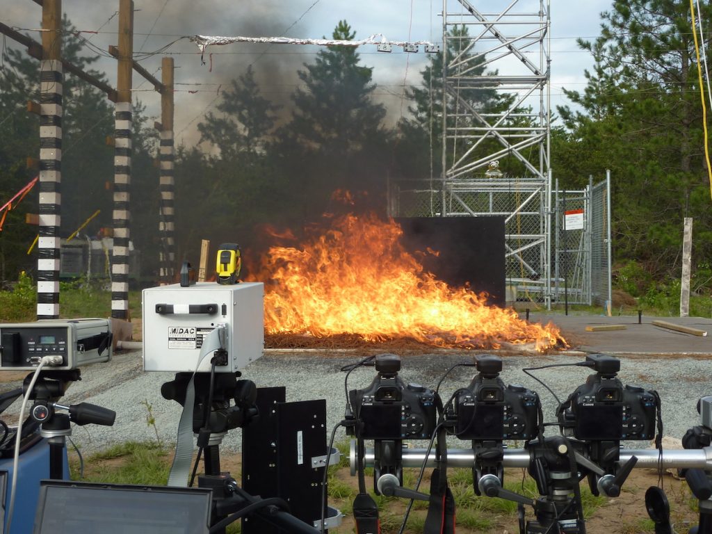
Methodology: In the first phase the student will work on measurements of fires conducted within an experimental combustion chamber. Measures of the electromagnetic energy emitted from the fires at wavelengths from the visible to the thermal infrared will be used to determine which remotely sensed metrics best relate to smoke composition and smoke production rate. The student will then analyse data from airborne remote sensing campaigns already conducted over fires, with potential for these to be augmented with more data later in the studentship. See examples of methodologies in:
Freeborn, P.H., Wooster, M.J., Hao, W.M., Ryan, C.A., Nordgren, B.L., Baker, S.P. and Ichoku, C., (2008). Relationships between energy release, fuel mass loss, and trace gas and aerosol emissions during laboratory biomass fires. https://agupubs.onlinelibrary.wiley.com/doi/pdf/10.1029/2007JD008679
Amici, S., Wooster, M.J. and Piscini, A. (2011). Multi-resolution spectral analysis of wildfire K emission signatures using laboratory, airborne spaceborne remote sensing. https://doi.org/10.1016/j.rse.2011.02.022
Focus will be on thermal signals emitted by the fires in the shortwave to thermal infrared spectral regions, and potentially in the near infrared as a result of the thermal excitation of potassium held within the vegetation. Once the most informative metrics are identified, physically based approaches to derive those metrics will be used to produce data that can then be explored, and also used within machine learning approaches targeted at deriving the same information and which are potentially scalable to airborne and satellite remote sensing. Methods to geometrically and radiometrically correct the airborne data will also be evaluated.

Studentship Overview
The student will be supervised by Professor Martin Wooster of the Department of Geography, King’s College London (KCL) and the NERC National Centre for Earth Observation. Professor Wooster is an expert in Earth Observation Science and in the study of landscape fire and its impacts on the land and the atmosphere. The project will involve substantial study of real fires, both in the laboratory and probably also in the field, potentially from aircraft overflights. The student will join the Environmental Dynamics Research Group within the Department of Geography, King’s College London, and be affiliated to the Leverhulme Centre for Wildfires, Environment and Society within which Prof. Wooster is an Associate Director.
The studentship will be funded at £17,285 stipend per annum including London allowance (rising in line with annual increments), plus fees (UK or EU students only) paid for 3.5 years. There will be support funding for project costs, fieldwork and conference attendance. The studentship is available from September 2020 and the student will join the London NERC DTP 2020 Cohort for certain parts of their training programme.
Applicant Background and Application Process
Applicants should have a have a 2:1 or higher degree in a science subject, in geography (quantitative), or in allied fields such as computing or engineering (or equivalent experience). Some knowledge and past experience of remote sensing is very welcome but not absolutely necessary. Students working towards or already having a Master’s degree in a relevant field (and expecting a distinction or high merit grade) are particularly welcome to apply. The successful applicant will have a strong academic background, the ability to communicate to high standards, an interest in working with equipment as well as digital data, and enthusiasm regarding this topic. They will join a vibrant and engaging research group, and regular group meetings, joint working at the combustion chamber (located 30 mins north of London by train) and possible participation in overseas field campaigns will be a feature of the research.
Application deadline is 16:00 hrs on 18th June 2020
Interviews will take place before the end of June, most likely by teleconference.
To apply, applicants should download and follow the instructions in the studentship application form:
https://www.dropbox.com/s/q3nfxxnooz6ujmz/PhD%20Application%20form.docx?dl=0
The link at the far right of the page ‘…’ has the download option.
Applicants should also request that two academic referees complete the following online referee form prior to 15th June: https://london-nerc-dtp.org/apply-to-the-london-nerc-dtp/referee-form/
It is the applicant’s responsibility to ensure referee reports fit with the instructions detailed in the application form, and are uploaded by the 15th June referee deadline. Without these the studentship application cannot unfortunately be considered.
Any questions should be sent by 15th June 2020 to martin.wooster@kcl.ac.uk titled “NPIF PhD 2020”.


