High-latitude fires have the potential to shape the future of our climate in ways that we are currently incapable of predicting. Northern peatlands comprise the largest terrestrial carbon store, exerting a net cooling effect on the climate. However, as climate change is occurring most rapidly at high latitudes, the anticipated warmer and drier conditions are expected to heighten the vulnerability of carbon-rich peatlands to fire. Peat fires, which are considered the largest and most persistent fires on Earth, can significantly impact the global carbon cycle, atmospheric composition, climate, air quality, and human health, while feedback loops on climate change can also emerge (Figure 1).
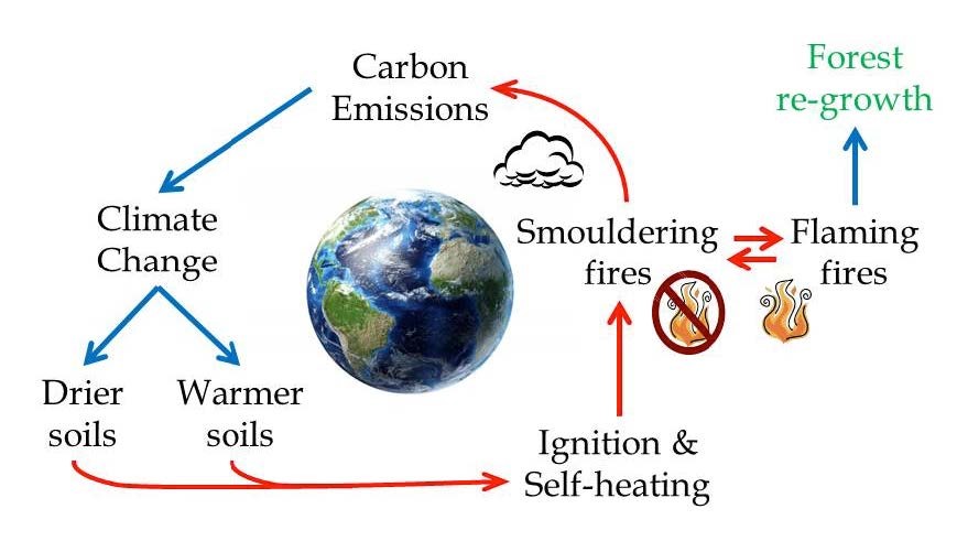
Figure 1. Positive feedback loop between smouldering fires and climate change (Rein 2013)

Representing peatland fire feedbacks to climate in Earth System Models (ESMs) is essential for accurately predicting the future of the climate system. Nevertheless, despite the urgency of the problem, largely, current ESMs lack peat fire and emissions capabilities.

A first approach to address this issue has been made by our Centre member Dr. Katie Blackford. Dr Blackford developed INFERNO-peat, the first parameterization of peat fires in the JULES-INFERNO (Joint UK Land Environment Simulator INteractive Fire and Emission algoRithm for Natural envirOnments) fire model. Initial simulations are very promising as compared to Global Fire Emissions Database version 5 (GFED5), INFERNO-peat captures ∼ 20 % more burnt area, whereas INFERNO underestimated burning by 50 % (Figure 2).
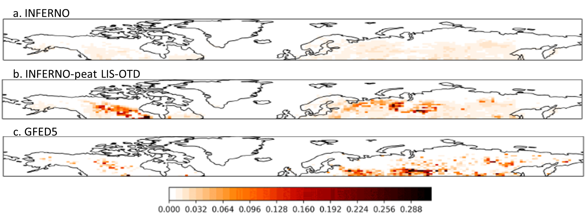
Figure 2. Average annual burnt area fraction (2010-2014) (Blackford et al., 2024)


This project, which is funded by the AXA Research Fund (AXA Chair in Wildfires and Climate) and the A.G. Leventis Foundation Educational Grant, and also supported by Leverhulme Wildfires, aims to further develop INFERNO-peat. A holistic approach that combines field research, cutting-edge lab experiments and real-time observational data is used to better quantify the impacts of wildfires on climate. Since peat moisture content and the resulting depth of burn have been experimentally proved to be critical for the representation of peat fires, we aim to incorporate those mechanisms into a further advanced global model functionality.

In close collaboration with Prof. Guillermo Rein (Imperial Hazelab), an expert in the field of smouldering combustion, and his world-leading team, a field trip in Thurso (Northern Scotland) for peat collection took place in March 2024 (Figure 3), and a series of experiments are currently being conducted in the lab, providing valuable information on how peat’s properties influence the ability of a peat fire to self-sustain, or otherwise to become extinct (Figure 4).
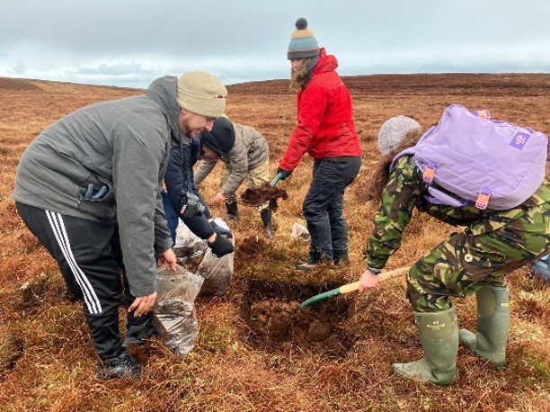
 

Figure 3. Collecting peat from a natural peatland
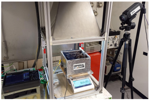
 

Figure 4. Experimental set-up in lab-scale


This study will develop the first peatland and thawing permafrost burning modelling capability for ESMs that is solidly based on emerging mechanistic understanding from the lab. It is expected to be a breakthrough in the understanding of how wildfires affect the climate system, with implications for climate services and policy.


Duration: 2023-2026


References

Rein, 2013, “Smouldering fires and natural fuels”, Phenomena and the Earth System, Belcher (Ed.), Wiley and Sons, 15–33, https://doi.org/10.1002/9781118529539.ch2

Mangeon et al., 2016, “Inferno: A fire and emissions scheme for the UK Met Office’s unified model”, Geosci. Model Dev., 9(8), 2685–2700, https://doi.org/10.5194/gmd-9-2685-2016

Blackford et al., 2024, “INFERNO-peat v1.0.0: A representation of northern high latitude peat fires in the JULES-INFERNO global fire model”, Geosci. Model Dev., 17, 3063–3079, https://doi.org/10.5194/gmd-17-3063-2024, 2024

Huang and Rein, 2017, “Downward spread of smouldering peat fire: the role of moisture, density and oxygen supply”, Int. J. Wildland Fire, 26(11), 907-918, https://doi.org/10.1071/WF16198
Leadership Team

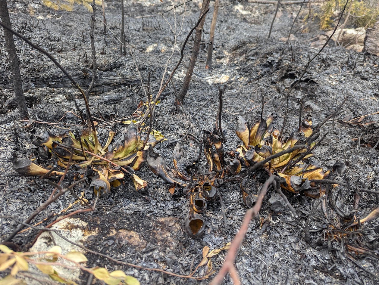
Peatlands are the world’s largest store of terrestrial carbon, an equivalent of around 2/3 of the carbon in the atmosphere is stored in boreal peatlands alone. Peatlands also support critical biodiversity and help protect from floods and drought. Wildfires pose an existential risk to peatlands and, since carbon is never fully re-sequestered, the climate. Estimates of emissions in literature don’t account for various critical determining factors, such as moisture content, carbon mineralisation, and metal content, as well as the dynamics of the water-table and peat surface.

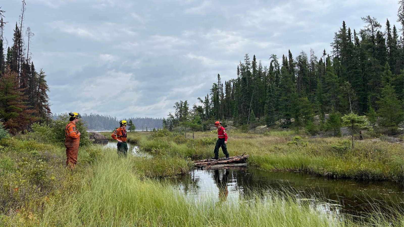
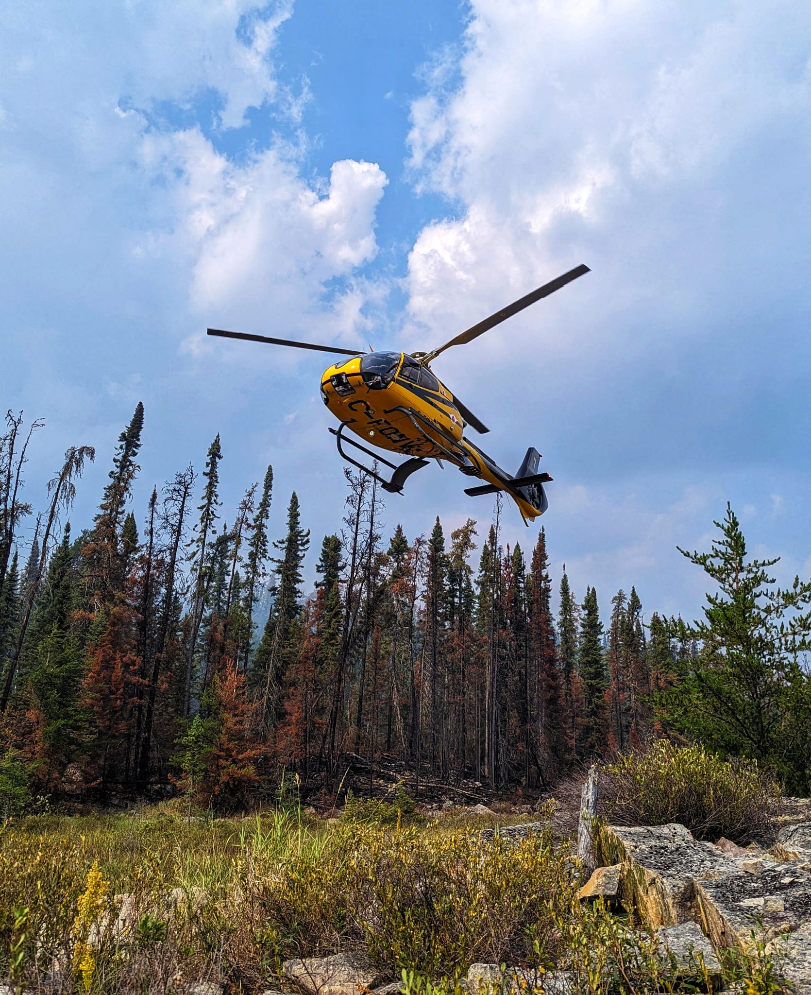
The project explores how different remote sensing datasets can quantify emissions from peatland wildfires. Lab-based pyrolysis and chemical experiments are used to evaluate the relation between fuel characteristics and fire smoke content. This is supported by field campaigns to Canada which have measured, from the ground and from fixed-wing aircraft, emission factors from boreal soils. A lot of the research work involved is developing and refining infrared hyperspectral remote sensing algorithms to measure emissions, both in the field and in the lab.

By improving our understanding of peatland emissions, particularly in relation to wildfires, we can strengthen the argument for peatland restoration and careful management, as well as providing improved estimates for emissions that can be fed into climate models. In addition, this research has potential to elucidate potential health concerns present from wildfires mobilising heavy metal content from the earth to the air.

Duration: 2022 – 2026

Images: by Luke Richarson-Foulger

Leadership Team

In high-latitude regions, larger and more frequent fires have been documented over the last years, and it is expected to increase further due to warmer temperatures and decreased precipitation imposed by climate change (IPCC,2019). Boreal wildfires in general are a significant source of CO2 emissions, as well as other, greenhouse gases (Akagi et al. 2011; Van Der Werf et al. 2010), e.g. emissions from boreal forests between 1997 and 2016 accounted for 7.4% of the global emissions (van der Werf et al. 2017).

The effect of boreal fires on the future climate has not been investigated and is of great importance since climate change is occurring more rapidly in those high-latitude areas. More flammable forests in addition to the large carbon-rich peatlands, will potentially lead to devastating consequences for our climate.

In our project, the combination of satellite data and earth system models will create an innovative methodological framework for the study of wildfires. More precisely, we will first characterize the state of the atmosphere and climate based on past and present wildfire conditions. The future impact of wildfires will be investigated, employing modeling, observations and new analysis tools.

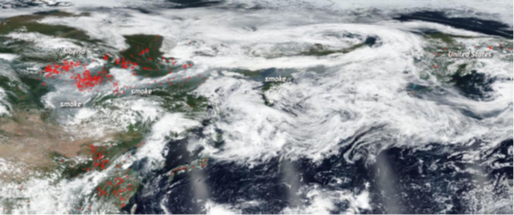
Figure 1. Hundreds of fires burning across Siberia on 30th July 2019, and the smoke produced heading towards North America (source: NASA). The summer of 2020 featured even more intense burning.  https://www.nasa.gov/image-feature/goddard/2019/siberian-smoke-heading-towards-us-andcanada


References

  • IPCC,2019: Jia, G., E. Shevliakova, P. Artaxo, N. De Noblet-Ducoudré, R. Houghton, J. House, K. Kitajima, C. Lennard, A. Popp, A. Sirin, R. Sukumar, L. Verchot, 2019: Land–climate interactions. In: Climate Change and Land: an IPCC special report on climate change, desertification, land degradation, sustainable land management, food security, and greenhouse gas fluxes in terrestrial ecosystems [P.R. Shukla, J. Skea, E. Calvo Buendia, V. Masson-Delmotte, H.-O. Pörtner, D.C. Roberts, P. Zhai, R. Slade, S. Connors, R. van Diemen, M. Ferrat, E. Haughey, S. Luz, S. Neogi, M. Pathak, J. Petzold, J. Portugal Pereira, P. Vyas, E. Huntley, K. Kissick, M, Belkacemi, J. Malley, (eds.)]. In press.
  • Akagi, S.K. et al., 2011: Emission factors for open and domestic biomass burning for use in atmospheric models. Atmos. Chem. Phys., 11, 4039–4072, doi:10.5194/acp-11-4039-2011.
  • Van Der Werf, G.R. et al., 2010: Global fire emissions and the contribution of deforestation, savanna, forest, agricultural, and peat fires (1997–2009). Atmos. Chem. Phys., 10, 11707–11735, doi:10.5194/acp-10-11707-2010.
  • Van Der Werf, G.R. et al., 2010: Global fire emissions and the contribution of deforestation, savanna, forest, agricultural, and peat fires (1997–2009). Atmos. Chem. Phys., 10, 11707–11735, doi:10.5194/acp-10-11707-2010.

Leadership Team

This project aims to:

  • investigate atmospheric composition impacts of fire on a global scale and evaluate models’ ability to capture them.
  • quantify preindustrial to present-day radiative forcing of wildfire emissions.
  • explore impacts of short-lived fire-emitted pollutants on future climate, globally and regionally.

This project will be the first to systematically explore fire effects on atmospheric composition and climate using a wide synergy of simulations and modelling. The focus will be on short-lived species, namely aerosols and ozone precursors. Furthermore, this project aims to involve the use of targeted simulations (primarily from satellites) and a carefully selected suite of observations that will help evaluate the models’ ability to simulate atmospheric composition and the role of wildfires, in a process-based way. Model sensitivity experiments, in conjunction with the observations, will help identify the role of wildfires in past and future climates. Specifically, this project’s objectives will be on preindustrial to present-day radiative forcing of wildfire emissions, and on exploring climate feedback and impacts on future atmospheres.

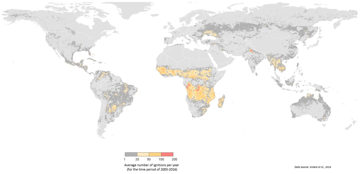
Fig1. Global map showing the average number of ignitions per year for the period 2003 to 2016. The data used were derived from Andela, N., Morton, D. C., Giglio, L., & Randerson, J. T. (2019). Global fire atlas with characteristics of individual fires, 2003-2016. ORNL DAAC. Oak Ridge, Tennessee, USA. https://doi.org/10.3334/ORNLDAAC/1642


Leadership Team

Recent Arctic wildfires have burned previously unheard-of expanses of land and released significant amounts of prehistoric carbon into the atmosphere through smouldering fire. Due to their remote location and insufficient thermal signature, Arctic fires are poorly understood and challenging to detect. We are working on this project in order to understanding of the smouldering fire in this area can be beneficial to develop prevention and mitigation strategies.

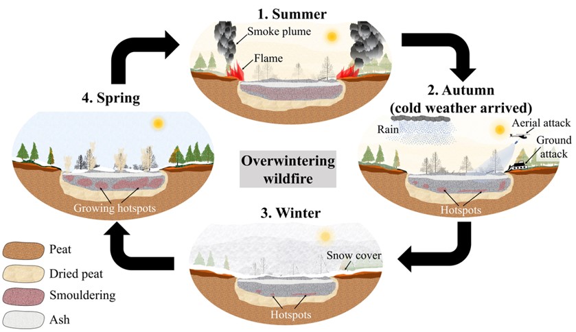
Due to the persistent nature of the smouldering phenomena, smouldering wildfires pose a different threat from flaming fire. There have been instances where fires started in the summer continued to burn underground throughout the winter and then surfaced once the snow had melted [1]. Such fires that reappear after the winter season is through are known as zombie fires, since it once seemed that they were extinct in the autumn and then reappear in the spring [2]. However, they are more frequently referred to as holdover fires or overwintering fires (Fig. 1) [3, 4]

Figure 1. Illustration of the overwintering wildfire: the survival of the smouldering fires over winter which re-emerge during the arrival of spring (Rein and Huang 2021).


References:

[1] Jandt R, Thoman R (2020) The “Zombie” Fires of 1942.

[2] Vaughan BA (2020) ’ Zombie ’ fires are burning the Arctic after smouldering under snow. New Sci. 1–5.

[3] Rein G, Huang X (2021) Smouldering wildfires in peatlands, forests and the arctic: Challenges and perspectives. Current Opinion in Environmental Science & Health 24, 100296.

[4] Scholten R, Veraverbeke S (2020) Fires can overwinter in boreal forests of North America doi:10.5194/egusphere-egu2020-6013.

Leadership Team

Wildfires are integral part of global ecosystems. At the same time, they pose a threat for the manmade environment and constitute a major CO2 emission producer. Changes in the burned area by wildfires have been widely attributed to respective changes in climatic drivers. Understanding the connections between climate parameters and the wildfire activity has a great scientific and managerial importance. In this project we analyze observed burned area (BA) sizes on different Global Fire Emissions Database (GFED) pyrographic regions, and the respective Fire Weather Index (FWI), to identify correlations between them.

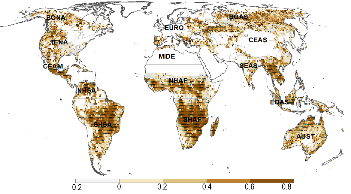
At a global scale, a rough 42% of the area that exhibit any correlation between BA and FWI, show statistical significance at 95% level. The region with the highest rate of significant positive correlation is South Africa (SHAF) with a rough 82% fraction of area exhibiting statistical significance, followed by Central and South America, and Equatorial Asia regions, with an approximate 60%. The project is currently exploring alternative techniques to correlate FWI, but also climate parameters to BA.

Figure: Pearson’s correlation coefficient between FWI and log10(burned area). Stippled regions correspond to p value < 0.05. Grid-boxes with 5 months or less of recorded burned area were not considered. FWI data from NASAs reanalysis project MERRA2[1], burned area estimates from MODIS (MCD64A1)[2]. Period of analysis, 2001-2015.

[1] https://portal.nccs.nasa.gov/datashare/GlobalFWI/v2.0/wxInput/MERRA2/

[2] Giglio L, Boschetti L, Roy DP, Humber ML, Justice CO. The Collection 6 MODIS burned area mapping algorithm and product. Remote Sens Environ. Elsevier Inc.; 2018 Nov 1;217:72–85.

Leadership Team

The focus of this project is to interact with all project scientists in order to continuously develop and advance our capabilities in global wildfire modelling and its integration into Earth system models. The tasks will involve a) Algorithm development based on quantitative and qualitative insight from individual projects in different strands; b) Model evaluation and benchmarking; c) Integration into the UK Earth System Model (UKESM) and subsequent evaluation of performance of atmospheric composition, vegetation, and related systems. 


Project duration: 2020 – ongoing

Leadership Team

Partners