
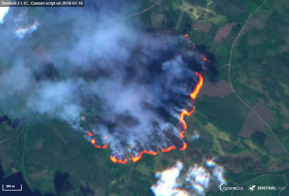
Image: A forest fire burning in Enskogen, as seen by Sentinel-2 on 16th July
(Contains modified Copernicus Sentinel data [2018], processed by the Copernicus Support Office)
King’s College London will be one of 39 partners from across the world involved in the new research project FirEUrisk, starting this month, which will develop a science-based strategy for wildfire risk management in Europe.
Wildfires provide benefits within certain ecosystems, but they can also be ecologically damaging if they have certain characteristics, such as extreme intensity and size. They can also pose a direct threat to infrastructure, human life and, through their impact on air quality, on the health of people living even far from the fires themselves.
Current approaches to wildfire risk management can involve high-cost suppression operations along with controversial policies that lead to inefficient risk management and severe damage. The four-year FirEUrisk project, funded by a 10million euro grant from the European Union, will develop a new approach which will include innovative technologies, tools, training materials, guidelines and policy recommendations to improve wildfire management and reduce the most damaging effects of the fires.
Professor Martin Wooster, Associate Director of the Leverhulme Centre for Wildfires, Environment and Society, and his research group in King’s Department of Geography, who are also part of NERC’s National Centre for Earth Observation, will be part of a multi-disciplinary team which includes researchers, practitioners, policymakers and citizens, coordinated by Dr. Domingos Xavier Viegas from the University of Coimbra, Portugal.
They will use data from European satellites, from EUMETSAT and the Copernicus programme, to make smoke emissions estimates from each identified wildfire. They will also develop their existing data products to provide more precise and timely information on European fires.
The improved emissions estimates developed in KCL will then be used in air quality models, providing a route to better understanding the impacts of the fires smoke on human health. This could potentially deliver early warnings to citizens about episodes of polluted air so they can take action to minimise exposure.
“The FirEUrisk project is bringing together a huge range of European and UK expertise to better understand the risks that wildfires pose, and ways in which this can be mitigated against using knowledge, technology and planning. The exploitation of Earth Observation satellites is one part of this – and if accurate satellite-derived information on fire and smoke can get to decision makers quickly it is likely to be one tool that can improve the management and response to fire events across Europe.”
– Professor Martin Wooster, Chair of Earth Observation Science at King’s and Associate Director of the Leverhulme Centre for Wildfires, Environment and Society
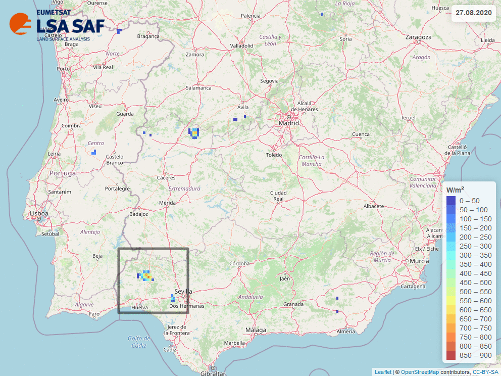
Figure – Animation of daily maximum fire radiative power from 27th until 30th of August 2020, expressed in Watts per square meter, using FRPPIXEL product. Maximum FRP for each pixel is selected as maximum value of FPR within a day. Area inside black square corresponds to province of Huelva (Source: LSA SAF /KCL)
FirEUrisk will also study the vulnerability and resilience of communities and countries to wildfires to create a new approach which reduces current fire risk conditions, and which also guides both the response to the wildfire emergency and the recovery. The resulting strategy will then be tested in different pilot sites and demonstration areas around Europe.
In the face of growing threat of wildfires in many parts of Europe, the information from the project will allow the creation of regional planning approaches that will increase the resilience and safety of local communities.
