
by James Millington (King’s College London)
If you do a Google Scholar search for ‘human’ or ‘anthropogenic’ and ‘landscape fire’ you’ll be returned over 5,000 papers. From this you might conclude that there’s lots of information available to enable a coherent global understanding of human impacts on landscape fire. Surprisingly, that’s not the case, and global models of vegetation and fire – like those compared in the FireMIP project – do not make use of this information to simulate the occurrence of fire. One reason for this is that no one has collated the information of the many disparate landscape studies – studies that use a huge range of different methods in many disparate fields – into a single dataset to characterise how humans impact fire regimes. So, that’s what we set out to do.
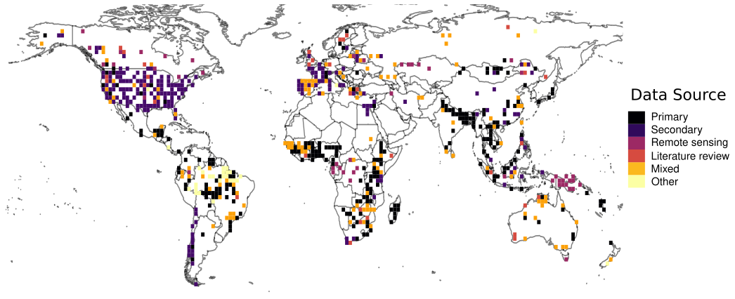
We constructed the freely available Database of Anthropogenic Fire Impacts (DAFI) from a meta-analysis of 1,800 worldwide case studies of landscape fire. DAFI represents the most comprehensive meta-analysis of global fire use to date, spanning all key land systems and policy regimes from over 105 countries on all continents (except Antarctica) between 1990-2020 from 523 papers. The types of study included in DAFI vary across space; as the map above shows we find a prevalence of secondary studies in Europe and North America versus a dominance of primary studies in Asia and Africa.
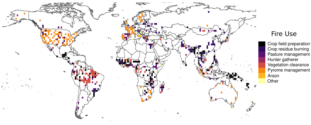
Analysis of DAFI – presented in our recently published paper – revealed that seven fire-use types account for >90% of case studies. As the map below shows, the seven fire-use types are dominant in different parts of the world. Pyrome management activities dominate in North America and Europe, while vegetation clearance is a primary use across much of Brazil, and crop residue burning is dominant across parts of Asia. We also found distinctive quantitative signatures in the different fire uses, for example with fires burned in croplands to prepare fields generally having a much smaller size than broadcast fires used to prepare pasture for livestock. Incorporating this quantitative information into global models of vegetation and fire is a next research aim.
Beyond global modelling, data in DAFI can also help understanding other issues, such as regional differences in why and when people burn on croplands. For example, the map below shows how use of fire for crop field preparation is prevalent in South America and sub-Saharan Africa (where shifting cultivation remains widespread) but crop residue burning is prevalent in areas of intensive (or intensifying) agriculture in regions like northern India and north-eastern China.
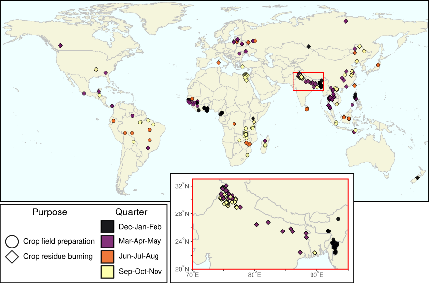
Data in DAFI also provide insights into how fire use may be changing. For example, as the inset in map above shows, a transition from burning for field preparation to post-harvest residue burning in intensifying systems seems to be present in northern India where winter cropland field preparation dominates in the northeast but spring–autumn crop residue burning characterises the northwest.
We hope that DAFI will be useful for scientists trying to improve global vegetation and modelling, but also to those with more regional interests in fire use. DAFI is freely available here and we encourage people to explore how they can use the data in their own work. More details on the construction and characteristics of DAFI is available here.
