By Natalie Sanders and Yicheng Shen
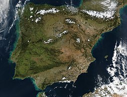
The Iberian Peninsula, home to Mediterranean beaches and mountains, pine trees and paella, sangria and siestas. But this southwestern region of Europe, mostly comprised of Portugal and Spain, is also a region known for its long history of being the most fire-affected region in southern Europe.
It is important to understand how wildfires have changed over time and we can use satellite data to reconstruct wildfires from the last 20 years or so. To understand how wildfires have changed during longer time periods, before significant human impacts, we need to make use of paleo records such as charcoal and pollen data from the pre-industrial Holocene (12000yrs BP to ca 1850 CE).
Not only does the Iberian Peninsula have a long history of wildfires, but it also has abundant pollen and charcoal records that cover the Holocene region and so it is the perfect study site for this new paper published in Climate of the Past by Yicheng Shen et al:
Reconstructing burnt area during the Holocene: an Iberian case study.
There are multiple factors to consider when investigating fire regimes: climate and fire weather, vegetation properties and human activities. Using sedimentary charcoal, which has been preserved in lakes and peat bogs, is the standard approach when reconstructing past fire regimes. However, it only provides a semi-quantitative indication of fire activity rather than quantitative estimates of burnt area or biomass loss. Furthermore, the results are site specific and therefore limited in terms of understanding widespread fire patterns.
Pollen-based paleoclimate models have long exploited the multivariate nature of pollen assemblages to reconstruct difference aspects of climate. A region’s vegetation properties can determine the amount of fuel availability and so can be a strong determinant on fire occurrence. Paleo vegetation data, such as pollen data, could provide a potential alternative to develop a more quantitative reconstruction of the past fire regimes. The big benefit of pollen data over charcoal is that there is a huge amount more data available allowing information at a much broader geographical scale without the need for modelling.
The question is, can past pollen assemblage records accurately reconstruct fire regimes as well as, or better than charcoal records?

Figure 1. Flow chart of the methodology of burnt area reconstructions
To answer this, the study had three main stages (as shown in figure 1):
- Relate the modern charcoal abundance to burnt area using conversion factors derived from a generalised linear model (GLM) of burnt area probability.

where modern charcoal data are the core-top binned charcoal data in the j th entity, and the present-day burnt area fraction in the j th entity was obtained from the GLM.

Where i means ith sample.
- Establish the quantitative relationship between fossil pollen assemblages and burnt area using Tolerance-weighted Weighted Averaging Partial Least-Squares with a sampling frequency correction (fxTWA-PLS) (Liu et al, 2020)
- Use the vegetation-burnt area relationship to reconstruct changes in burnt area through time from the pollen records, including sites with no charcoal records.
The central premise to the approach taken in this study is that fire frequency is one of the factors that influences vegetation assemblages and therefore that specific aspects of differences in vegetation assemblages can be used to reconstruct fire. The relationship between pollen assemblage and burned area was derived using 31 entities that hold both modern and fossil charcoal and pollen data. This was then compared to the 113 entities of burnt area in the Iberian Peninsula with pollen records to reconstruct changes in fire regimes during the Holocene.
The overall relationship between pollen and charcoal-derived burnt area derived by fxTWAPLS is reasonably strong (R2= 0.44), this demonstrates the importance of vegetation properties in driving the occurrence of fire. We know this to be true from the GLM analysis of modern fire patterns, but this paper demonstrates it for historical fires using the paleo records. In the Iberian Peninsula, vegetation patterns, as well as the occurrence of dry intervals are important controls on modern fire patterns.


Figure 2. Temporal and spatial patterns reconstructed burnt area
Whilst this study has demonstrated that it is possible to derive trends in burnt area through time by applying a quantitative relationship between pollen assemblages and charcoal-derived burnt area to palaeo-vegetation records, there are still some biases in the results. This method overestimated at the low end and underestimated at the high end of the burnt area range. Further testing with a larger data set to cover a wider range of vegetation types and fire regimes would be useful.
Nevertheless, key patterns in reconstructed burnt area are consistent with known Holocene climate changes in this region such as the ‘Medieval Warm Period’ and the ‘Little Ice Age’. The results show that climate, and climate-induced changes in vegetation, have influenced the fire regimes of the Iberian Peninsula during the Holocene, but human activity has also been important, particularly from the Bronze Age onwards, with human activity consistently having a negative effect on burnt area under modern conditions.
This novel approach of using pollen data opens up the possibility of reconstructing changes on a finer-scale and in regions where charcoal data is limited.
You can get the paper here:
Shen, Y., Sweeney, L., Liu, M., Lopez-Saez, J.A., Perez-Diaz, S., Luelmo-Lautenschlaegerer, R., Gil-Romera, E., Hoefer, D., Jimenez-Moreno, G., Schnedier, H., Prentice, I.C. and Harrison, S.P. 2022. Reconstructing burnt area during the Holocene: an Iberian case study. Climate of the Past. 18, 1189–1201, https://doi.org/10.5194/cp-18-1189-2022
Reference:
Liu, M., I.C. Prentice., C. J. F. ter Braak., S.P. Harrison (2020). An improved statistical approach for reconstructing past climates from biotic assemblages. Proc. R. Soc. A. 476: 20200346. https://doi.org/10.1098/rspa.2020.0346

Yicheng Shen is a current PhD student at the University of Reading funded by the LEMONTREE project. She conducted her Master’s at Imperial College London under the supervision of Prof Prentice and continues to collaborate with the REALM team. Her PhD focuses on the relationships between fire and fire-related plant traits (e.g. resprouting), with the ultimate goal to develop a theoretical basis for predicting fire regimes and develop a simple fire model incorporating plant controls on traits in fire-adapted vegetation.
This paper was co-authored and by funded by REALM members Mengmeng Liu and Colin Prentice and the Leverhulme Centre for Wildfire, Environment and Society member Luke Sweeney from Imperial College London.


